Menú local
Technical resources and instruments:
The development of the projects performed by our research group is based on several technical resources and instruments. The laboratory of this group is situated on the Engineering and Technology Building (A3) at the Campus de las Lagunillas of the University of Jaén. This space is complemented with the laboratory of Calibration and Industrial surveying which is located at the same building.
The research equipments are mainly composed by the technical resources of the Departamento de Ingeniería Cartográfica, Geodésica y Fotogrametría of the University of Jaén and by the equipments of the Technical Services of the University of Jaén.
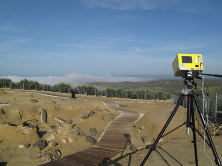
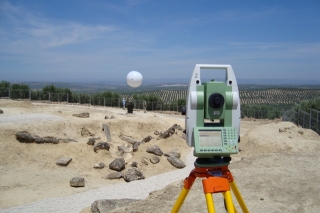
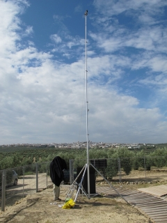
The group also own or has access to different instruments of which we can note: One Terrestrial Laser Scanner Ilris Optech (long range of distances 1500m), another system TLS Leica Scanstation C10 (medium range of distances), one system laser scanner Minolta VI-900 (close range of distances), workstations for treatment of data from laser scanner ( software Maptek I-Site Studio, Polyworks, Terramodel y Leica Cyclone), one photogrammetric scanner Vexcel Ultrascan 5000, several digital photogrammetric workstations equipped with stereoscopic vision and 3D mousses (software BAE System Socet Set and Leica Photogrammetric Suite), GNSS-RTK systems (Topcon and Leica), several cameras and accessories for developing terrestrial photogrammetric works (Canon D30, Canon D5, Canon Powershot G10, 2 Canon Powershot G12) and several platforms of which we have to note one mast of 10 m and one helium balloon for providing images from certain height.
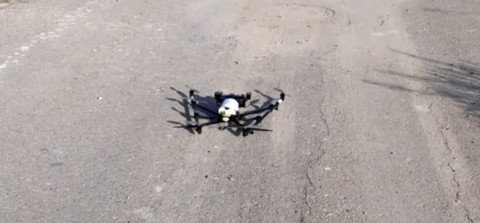
We also have several Unmanned Aerial Vehicles (UAVs) such as an Asctec Falcon and a Drone from Atyges.