|
|||||||||||||
PresentationClimate change, earthquakes, floods, thaw assessment, forest fire assessment, deforestation, desertification, civil protection, territorial planning, European Common Agrarian Policy, International Aid in Emergencies and Crises, etc., are society challenges where geospatial data and, specifically, the digital terrain elevation models (DEM), support the decision making process. Geospatial data is considered as a foundation element for good governance by the World Bank (WBG, 2009), the European Union (GINE 2003) and the United Nations (Salvemini 2009). Geospatial data are an important component of Ambient Intelligence technologies as they give ubiquity and context to captures from non-spatial sensor networks. Quality is a key component of geospatial data, according to the European (EEA 2015) and American (FEMA 2015) environmental agencies, and from a scientific viewpoint it is a challenge (Devillers et al. 2010). The idea of "functional quality" refers to the level to which DEMs allow users to obtain useful results when applying geospatial modeling and analysis operations (e.g. drainage network, river basin, etc.). The current way of reporting the quality of a DEM focuses on positional accuracy and is based on indices such as mean value (bias), deviation, or RMSE. These indices are calculated on few control points and they report from a global perspective. Consequently, for many specific applications (e.g. in hydrography, the determination of a drainage network or a micro-basin, etc.), an altimetric positional uncertainty is not very evocative of the application goal. Users would like to know whether data will actually produce quality results for their modeling (e.g. erosion, flooding, water balance, etc.). Therefore, for specific users to better understand the quality of a DEM, new measures are required that do have a strong relationship with the application results. Brouchure Here | |||||||||||||
ObjectiveThe FunQuality4DEM project aims developing evaluation and reporting methods for the "functional quality" of DEM on certain use cases. The novelties of this proposal are summarized in: 1) proposing the quality of the DEM data from a "functional perspective" (GIS analysis operations); 2º) proposing and formalizing new methods for DEM quality evaluation based on surfaces and lines; 3º) proposing and formalizing new measures and ways for reporting DEM data quality from a multivariate, local perspective and focused to specific USE CASES. To achieve the objectives, a high density LiDAR data set will be used; field work will be carried out with a Terrestrial Laser Scanner, and various statistical and mathematical tools will be used (e.g. simulations, surface adjustments, splines, multivariate statistics, etc.). The results will be considered to validation by experts in the use cases. This project is of great interest to society because its application to DEM will allow better decisions to be made in civil and environmental engineering projects from the available DEMs. Furthermore, FunQuality4DEM is of great interest to the geomatic industry, as proved by the support received from national and international organizations producing and using DEM. | |||||||||||||
MetothodFunQuality4DEM is organized into phases (Fx) and activities (Ax). In summary, the process to be developed is as follows:
| |||||||||||||
ResultsScientific and methodological achivements
Presentation of the project "FunQuality4DEM" (Functional Quality for Digital Elevation Models). Results of the project "FunQuality4DEM" (Functional Quality for Digital Elevation Models). Tools | |||||||||||||
Publications (papers, congress, etc.) :2023Mozas-Calvache, A.T.; Ureña-Cámara, M.A. (2023). Identification of Highlighted Cells in Low-Variance Raster Data Application to Digital Elevation Models. Algorithms 2023, 16(6), 302; https://doi.org/10.3390/a16060302 López-Vázquez, C.M.; Ariza-López, F.J. (2023). Global Digital Elevation Model comparison criteria: An Evident Need to Consider Their Application. ISPRS Int. J. Geo-Inf. 2023, 12, 337. https://doi.org/10.3390/ijgi12080337 Ruiz-Lendínez, J.J.; Ureña-cámara, M.A.; Ariza-López, F.J. (2023). Deep Learning Methods applied to Digital Elevation Models: State of the Art. Geocarto International, DOI: 10.1080/10106049.2023.2252389. Ariza-López, F.J.; Rodríguez-Avi, J. (2023). Quality control of DEMs by check surfaces. submitted to publication. Reinoso-Gordo, J.F.; Ariza-López, F.J. (2023). A method to rank global DEMs quality focused on their horizontal accuracy. Geomorphometry 2023, Iasi, Romania. Ariza-López, F.J.; Reinoso-Gordo, J.F. (2023). Functional Quality for GDEMs Assessment. Geomorphometry 2023, Iasi, Romania. Ariza-López, F.J.:Ureña-Cámara, M.A., Reinoso-Gordo, J.F.; Nero, M.A. (2023). Proposal for a Collaborative Data Infrastructure for Control of DEMs. Geomorphometry 2023, Iasi, Romania. 2022Rodríguez-Avi, J.; Ariza-López, F.J. (2022) Finite Mixture Models in the Evaluation of Positional Accuracy of Geospatial Data. Remote Sens. 2022, 14, 2062. https://doi.org/10.3390/rs14092062 Ariza-López F.J., Domingo Barrera, Salah Eddargani, María José Ibáñez, Juan F. Reinoso (2022). Spline quasi-interpolation in the Bernstein basis and its application to digital elevation models. Mathematical Methods in the Applied Sciences. https://onlinelibrary.wiley.com/doi/10.1002/mma.8602 Salah Eddargani, Domingo Barrera, María José Ibáñez, Juan Francisco Reinoso-Gordo, Francisco Javier Ariza-López (2022). C2 Spline Quasi-Interpolation To Downscale A Digital Elevation Model. En The Fourteenth International Conference on Advanced Geographic Information Systems, Applications, and Services. GEOProcessing, Porto, Portugal, June 26-30, 2022
Ariza-López F.J., Reinoso-Gordo FJ. (2022).Functional quality: A use-case oriented quality evaluation. En The Fourteenth International Conference on Advanced Geographic Information Systems, Applications, and Services. GEOProcessing, Porto, Portugal, June 26-30, 2022.
Ariza-López F.J., Reinoso-Gordo JF, García-Balboa JL. (2022). A DEM quality dashboard: A multivariate quality assessment panel. En The Fourteenth International Conference on Advanced Geographic Information Systems, Applications, and Services. GEOProcessing, Porto, Portugal, June 26-30, 2022.
Ariza-López F.J., J.F. Reinoso-Gordo, J.L. García-Balboa (2022). Calidad en modelos digitales de elevaciones: una aproximación funcional. XIX Congreso de Tecnologías de la Información Geográfica: Las TIG al servicio de los ODS. Zaragoza, septiembre 2022.
Ariza-López F.J., J. Rodríguez Avi, J.F. Reinoso Gordo, A.T. Mozas Calvache, J.J. Ruiz Lendínez, J.L. García Balboa (2022). Evaluación de MDE por medio de parches de control. XIX Congreso de Tecnologías de la Información Geográfica: Las TIG al servicio de los ODS. Zaragoza, septiembre 2022.
Reinoso Gordo J.F., Ariza López F.J. (2022). Estimación de la exactitud planimétrica de la red de drenaje derivada de un modelo digital de elevaciones (MDE). XIX Congreso de Tecnologías de la Información Geográfica: Las TIG al servicio de los ODS. Zaragoza, septiembre 2022.
Ariza-López, F.J; Reinoso-Gordo, J.F.; García-Balboa, J.L. (2022). Informe gráfico sobre la calidad de modelos digitales de elevaciones. En XII TOPCART 2022, Sevilla.
Ureña-Cámara, M.A.; Ariza-López, F.J.; Ruiz-Lendínez, J.J. (2022). Identificación de puntos homólogos en mallas de modelos digitales de elevaciones. En XII TOPCART 2022, Sevilla.
Ariza-López, F.J.; Nero, M.A.; Ureña-Cámara, M.A.; Reinoso-Gordo, J.F. (2022). Infraestructura colaborativa de datos de control de modelos digitales de elevaciones. En XII TOPCART 2022, Sevilla.
Reinoso Gordo JF, Ariza-López FJ, José Rodríguez Avi, Domingo Barrera Rosillo (2022). DEMs: A Multivariate Comparison Approach. En ICTDEM 2022: XVI. International Conference on Topography and Digital Elevation Modeling, Amsterdam, SEPTEMBER 15-16, 2022
Reinoso-Gordo JF, Ariza-López FJ, A. Mozas-Calvache, J. L. García-Balboa, S. Eddargani (2022). Terrestrial Laser Scans to Assess Aerial LiDAR Data. En ICTDEM 2022: XVI. International Conference on Topography and Digital Elevation Modeling, Amsterdam, SEPTEMBER 15-16, 2022 2021 Alba-Fernández, M.V.; Ariza-López, F.J.; Jiménez-Gamero, M.D. (2021). A New Approach to the Quality Control of Slope and Aspect Classes Derived from Digital Elevation Models. Remote Sensing. 2021, 13, 2069 https://doi.org/10.3390/rs13112069 Ariza-López FJ, Reinoso-Gordo JF (2021). Comparison of Gridded DEMs by Buffering. Remote Sensing, 13(15) https://doi.org/10.3390/rs13153002 Ariza-López FJ, Reinoso-Gordo JF (2021). Métodos de orlado para la evaluación de la exactitud altimétrica en modelos digitales de elevaciones del terreno. Revista Cartográfica IPGH. https://doi.org/10.35424/rcarto.i103.975 Rodríguez-Avi, J (2021). Aproximación al error en MDE por mixtura de distribuciones. Revista Cartográfica IPGH. https://doi.org/10.35424/rcarto.i103.968 Alba-Fernández MV (2021). Aplicación de los test de equivalencia al control tipo temático de magnitudes asociadas a un modelo digital de elevaciones. Revista Cartográfica del IPGH. https://doi.org/10.35424/rcarto.i103.993 Mozas-Calvache AT (2021) Positional quality assessment based on linear elements. Revista Cartográfica del IPGH. https://doi.org/10.35424/rcarto.i103.911 Rodríguez-Avi J, Ariza-López FJ (2021). Finite mixtures of normal distributions in the study of the error in altimetry. En 30th International Cartographic Conference 2021, Florencia (Aceptado) ICC 2021 Florencia Ariza-López FJ, Reinoso-Gordo JF, Rodríguez-Avi J (2021). DEM's elevation comparison by surface buffering. En 30th International Cartographic Conference 2021, Florencia (Aceptado). ICC 2021 Florencia Eddargani S, Ariza-López, FJ, Barrera D, Ibáñez MJ, Reinoso-Gordo JF, Romero-Zaliz R, Ureña-Cámara M (2021). Low computational cost construction of 2D approximating splines and its application to Digital Elevation Models. En 2021 International Conference on Computational and Mathematical Methods in Science and Engineering (CMMSE) and the First Conference on High Performance Computing (CHPC), Rota, del 22-27 de julio de 2021. ICC 2021 Florencia Barrera D, Ariza-López, FJ, Eddargani S, Ibáñez MJ, Reinoso-Gordo JF (2021) Spline-based approximation of digital elevation models. En XV Biannual Congress of the Società Italiana di Matematica Applicata ed Industriale, Parma 2021 (participación on line). Horizontal accuracy assessment of a novel algorithm for approximate a surface to a DEM. En 30th International Cartographic Conference, Florencia, 14-18 Dicembre. Aceptado. ICC 2021 Florencia Barrera, D., Ibáñez, M.J., Salah, E., Romero, R., Ariza-López, F.J., Reinoso-Gordo J.F. (2021). Horizontal accuracy assessment of a novel algorithm for approximate a surface to a DEM. En 30th International Cartographic Conference 2021, Florencia. Aceptado. ICC 2021 Florencia Alba-Fernández MV, (2021). Multivariate and spatialised similarity analysis of two Digital Elevation Models via a large number of multinomials in a two-sample problem paradigm. Congreso ERCIM 2021. Aceptado. ERCIM 2021 2020Mesa-Mingorance, J.L.; Ariza-López, F.J. (2020). Accuracy Assessment of Digital Elevation Models (DEMs): A Critical Review of Practices of the Past Three Decades. Remote Sensing. Remote Sens. 2020, 12(16), 2630; https://doi.org/10.3390/rs12162630 Alba-Fernandez MV, Ariza-Lopez FJ, Jimenez-Gamero MD. (2020) Thematic-accuracy quality control of slope and aspect classes based on an equivalence test. CMStatistics. CMStatistics 2020 Some previous publications: 2019López-Vázquez, C. and Hochsztain, E.(2019). Extended and updated tables for the Friedman rank test. Communications in Statistics - Theory and Methods, 48, 2, 268-281 https://doi.org/10.1080/03610926.2017.1408829 2018Ariza-López, FJ, EG Chicaiza Mora, JL Mesa Mingorance, J Cai, JF Reinoso Gordo (2018). DEMs: An Approach to Users and Uses from the Quality Perspective. International Journal of Spatial Data Infrastructures Research (EU-Joint Research Centre). 13: 131-171. http://ijsdir.jrc.ec.europa.eu/index.php/ijsdir/article/view/469/430 Mesa-Mingorance JL, Ariza-López, FJ (2018). MDE: Referencias sobe evaluación de la calidad (1990-2017). GIIC Universidad de Jaén 2017Mesa Mingorance JL, EG Chicaiza Mora, X Buenaño, J Cai, AF Rodríguez Pascual, Ariza-López, FJ (2017). Analysis of Users and Uses of DEMs in Spain. ISPRS I.J. Geo Information (MDPI). 6(12) 406. doi.org/10.3390/ijgi6120406 Mozas Calvache, AT, Ureña Cámara, MA, Ariza-López, FJ (2017). Determination of 3D Displacements of Drainage Networks Extracted from Digital Elevation Models (DEMs) Using Linear-Based Methods. ISPRS I.J. Geo Information (MDPI). 6(8), 234. doi.org/10.3390/ijgi6080234 Padilla-Ruiz, M. y López-Vázquez, C. (2017). Measuring conflation success, Revista Cartográfica 94, 41-64 2016Mesa Mingorance JL, Chicaiza EG, Buenaño X, Jianhong C, Rodríguez-Pascual AF, Ariza-López FJ (2016). Análisis de los usuarios y usos de los MDE en España. Geofocus, nº 17. http://geofocus.org/index.php/geofocus/article/view/466/365 López-Vázquez, C. (2016). A protocol for the ranking of interpolation algorithms based on confidence levels, International Journal of Remote Sensing 37, 19, 4683-4697 https://doi.org/10.1080/01431161.2016.1219461 Before 2010López-Vázquez, C. y Manso Callejo, M. A. (2012). Point and Curve-Based Geometric Conflation, International Journal of Geographic Information Science, 27, 1, 192-207 https://doi.org/10.1080/13658816.2012.677537 Ariza-López, FJ; Ureña Cámara, M.A.; García Balboa (2010). Terra-Aster GDEM una posibilidad global para los catastros altimétricos. En 1er Congr. Int. sobre Catastro Unificado Multipropósito. Jaén, 2010. ISBN:978-84-8439-519-5 Cuartero, A, Felicisimo AM, Ariza-López, FJ (2005). Accuracy, reliability, and depuration of SPOT HRV and Terra ASTER digital elevation models IEEE Transactions on Geoscience and Remote Sensing 43 (2), 404-407 DOI: 10.1109/TGRS.2004.841356 Cuartero, A; Felicísimo, AM; Ariza-López, FJ (2004). Accuracy of DEM generation from Terra-ASTER stereo data. Proceedings XXth Congress ISPRS 2004. Estambúl. Comission VI, WG VI/4. Vol. XXXV, part B5. | |||||||||||||
StaffAccording to the call and the conditions of participation two teams are distinguished:
| |||||||||||||
Observer and promoter entitiesEntities promoting and participating in this project are the following:
| |||||||||||||
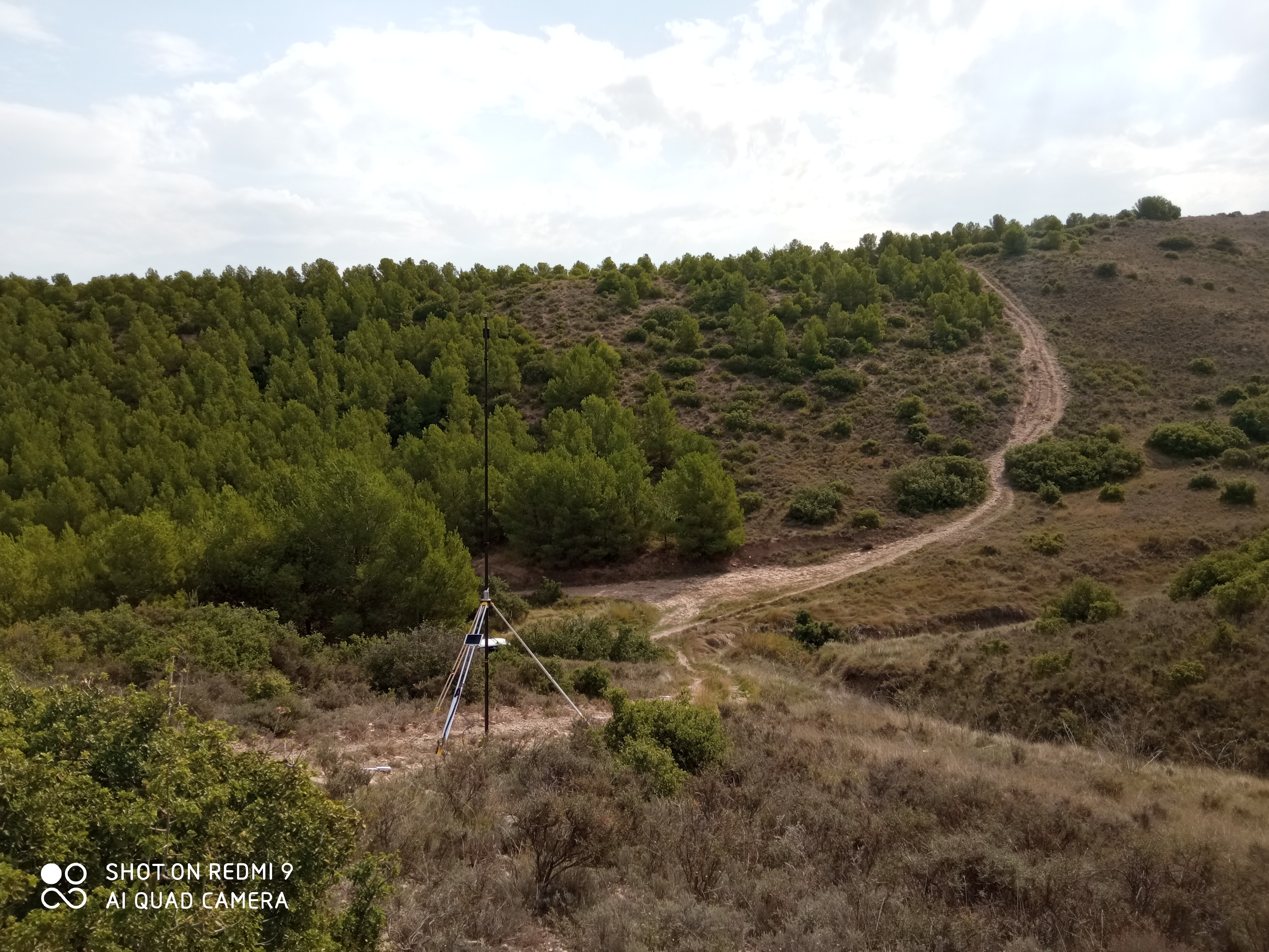
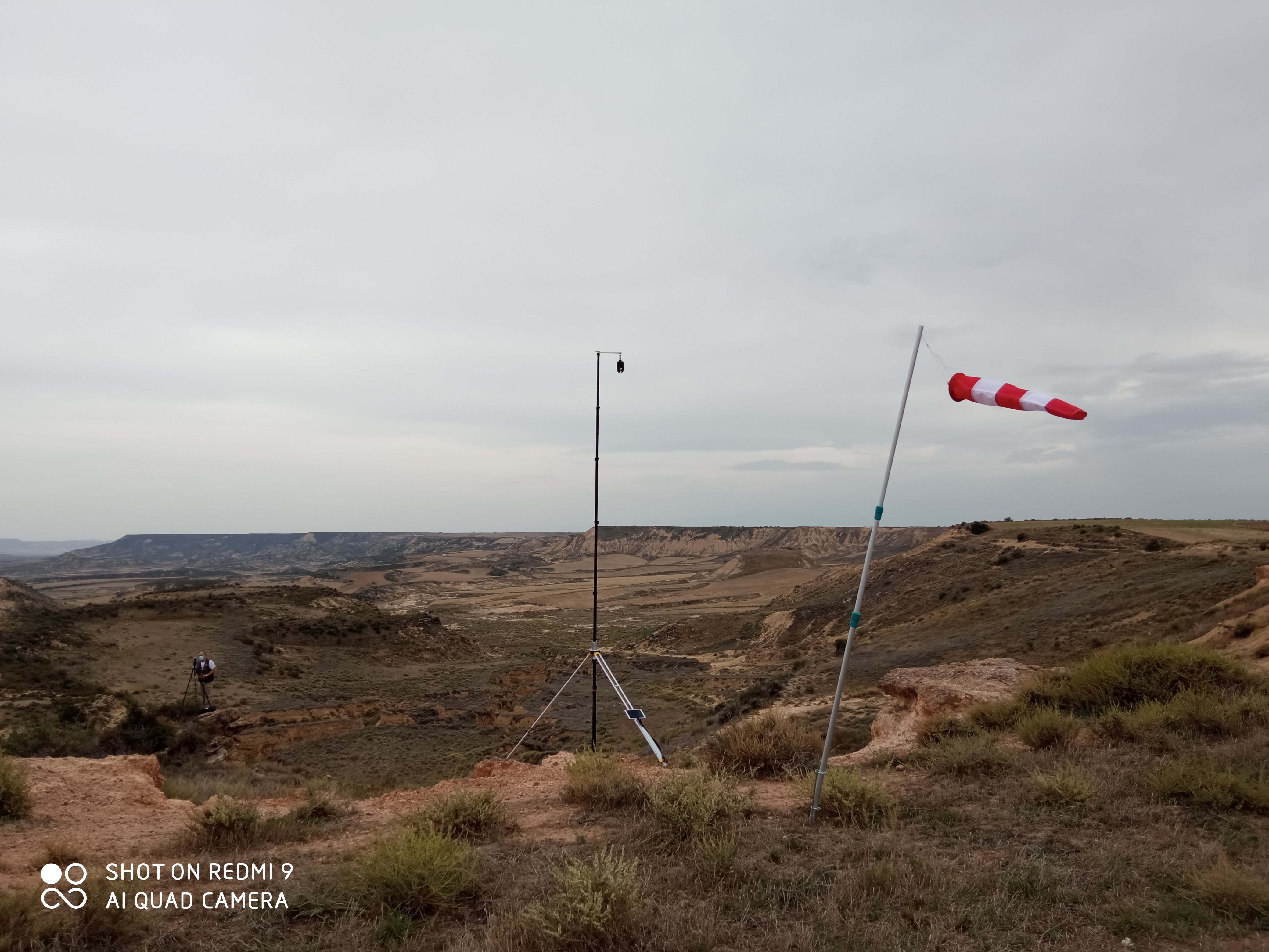
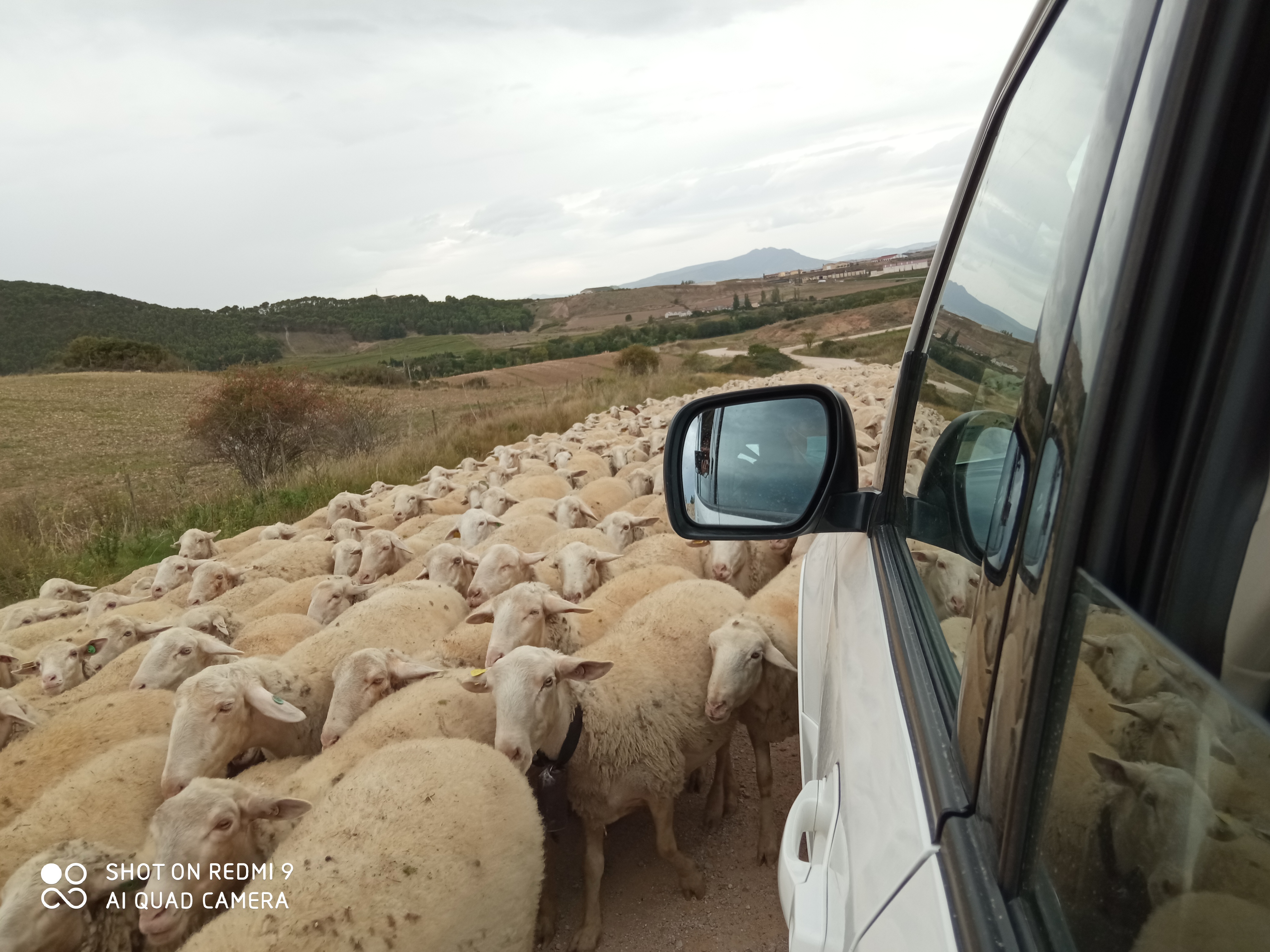
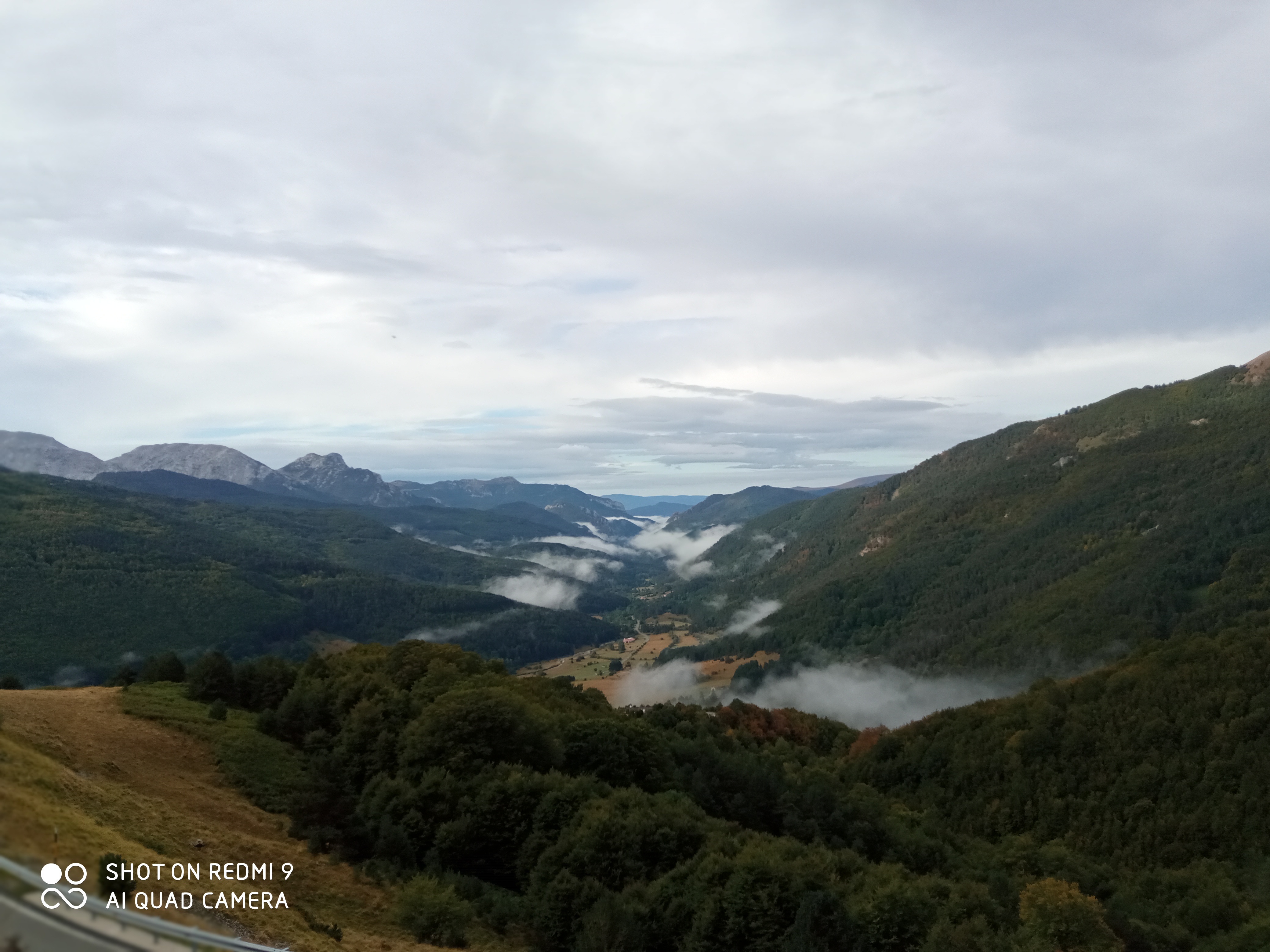
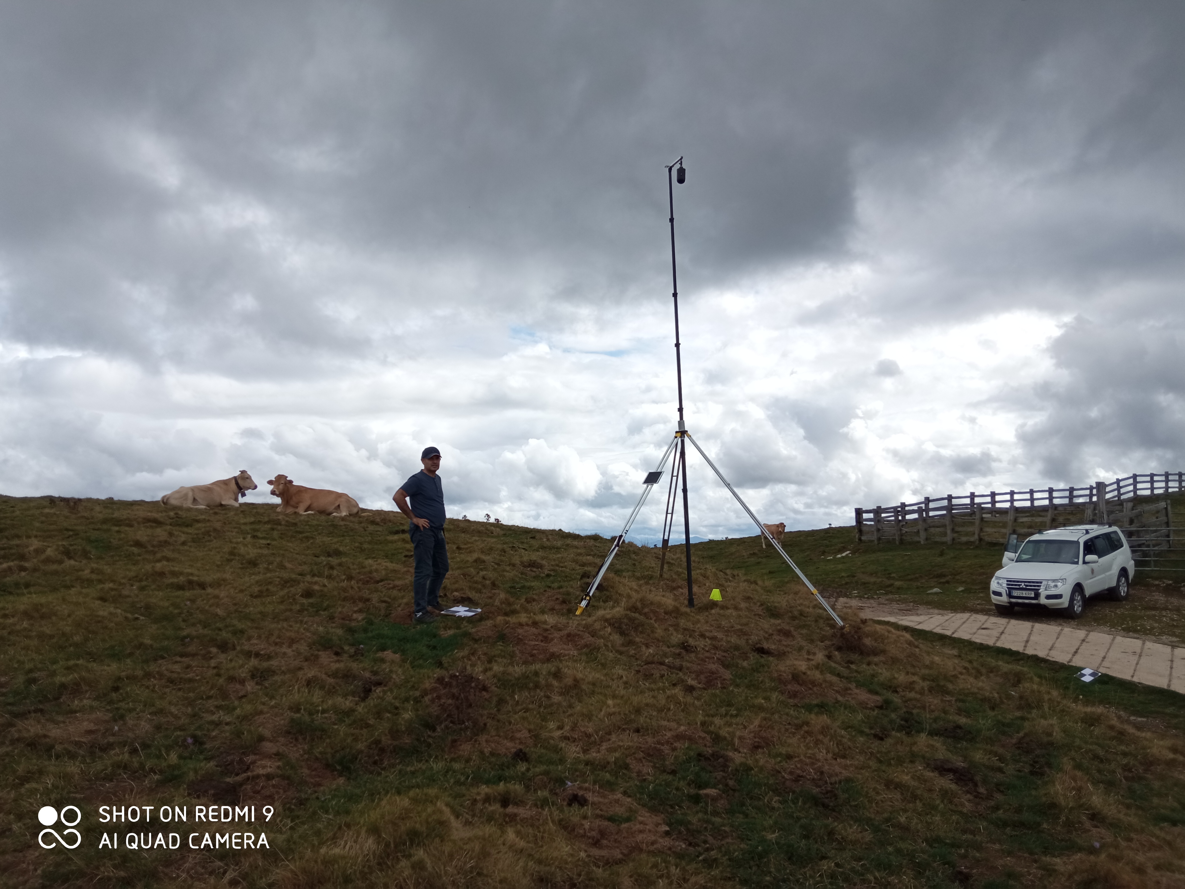
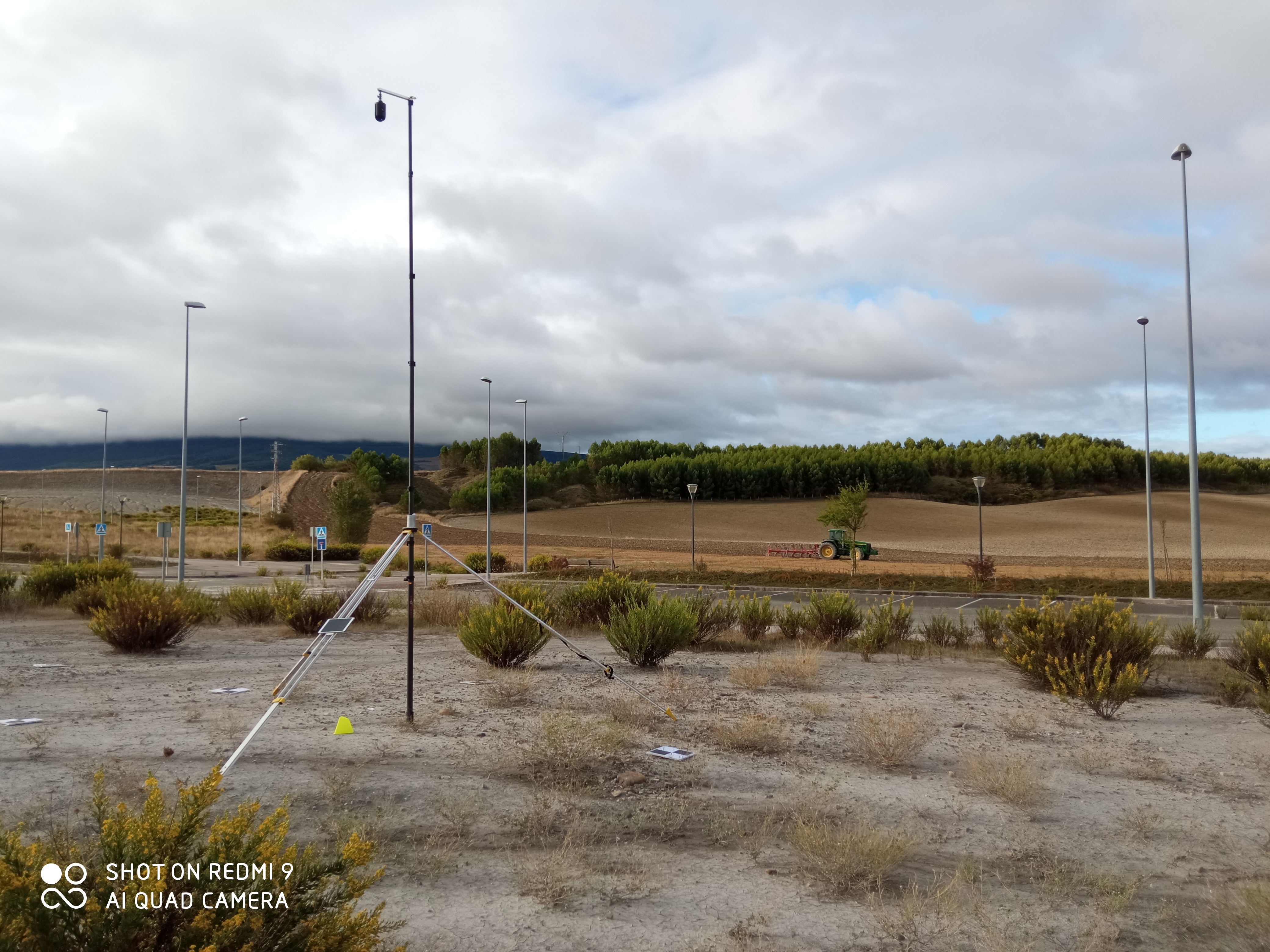
Photos
| |||||||||||||
LinksSome links of interest related to this topic are the following: EU-DEM digital surface model (DSM) World digital elevation model (ETOPO5) ASTER Global Digital Elevation Model (GDEM) Version 3 (ASTGTM) USA, 3D Elevation Program Standards and Specifications Digital Elevation Model - DEM Users Manual
| |||||||||||||
AcknowledgementsThis project is a collective work of a group of researchers that could not be carried out without the financial help of the Ministry of Economy and Competitiveness and the FEDER Funds and without many other supports that we also want to recognize from here:
| |||||||||||||
ContactIf you want to contact us:Francisco Javier Ariza López | |||||||||||||
References
[01] Oxera (2013). What is the economic impact of Geoservices. Prepared for Google. Oxera. https://www.oxera.com/wp-content/uploads/2018/03/What-is-the-economic-impact-of-Geo-services_1-1.pdf
[02] Altan O y col (2013). The Value of Geoinformation for Disaster and Risk Management (VALID) Benefit Analysis and Stakeholder Assessment. Joint Board of Geospatial Information Societies (JB GIS). http://www.un-spider.org/sites/default/files/VALIDPublication.pdf [03] Onsrud H (2009). Liability for Spatial Data Quality. En Devillers, Rodolphe and Helen Goodchild (Eds.), Spatial Data Quality: From Process to Decisions (New York: CRC Press) 187-196. https://doi.org/10.1201/b10305-22 [04] Chuvieco E (2010). Teledeteccion ambiental. Ariel. ISBN: 978-8434434981 [05] Gomez C y col (2015). A study of Japanese landscapes using structure from motion derived DSMs and DEMs based on historical aerial photographs: New opportunities for vegetation monitoring and diachronic geomorphology. Geomorphology. Vol 242, 11-20. https://doi.org/10.1016/j.geomorph.2015.02.021 [06] Saksena S y col (2015). Incorporating the effect of DEM resolution and accuracy for improved flood inundation mapping. Journal of Hydrolophy. Vol. 530, 180-194. https://doi.org/10.1016/j.jhydrol.2015.09.069 [07] Juel A y col (2015). Spatial Application of Random Forest models for fine-scale coastal vegetation classification using object based analysis of aerial orthophoto and DEM data. International Journal of Applied Earth Observation and Geoinformation. Vol. 42, 106-114. https://doi.org/10.1016/j.jag.2015.05.008 [08] Rekha P y col (2015). Assessment of impact of shrimp farming on coastal groundwater using Geographical Information System based Analytical Hierarchy Process. Aquaculture. Vol 448, 491-506. https://doi.org/10.1016/j.aquaculture.2015.06.025 [09] Petrie G y col (1987) Terrain Modeling in Surveying and Civil Engineering. Computer-Aided Design 19(4):171-187. http://petriefied.info/Petrie_Kennie_Terrain_Modelling_C-A-Design_1987.pdf [10] Babic S y col (2010) Digital Terrain Model Application in Road Planning and Design. International conference on Road and Rail Infrastructure, At Opatija, Croatia, Volume: 1. ISBN: 978-953-6272-38-9 [11] Mesa J y col (2017). Analysis of Users and Uses of DEMs in Spain. ISPRS Int. J. Geo-Inf., 6(12), 406. https://doi.org/10.3390/ijgi6120406 [12] Mesa J y Ariza FJ (2018). MDE: Referencias sobe evaluación de la calidad (1990-2017). GIIC Universidad de Jaén. [13] Ariza F y col (2018). DEMs: An Approach to Users and Uses from the Quality Perspective. International Journal of Spatial Data Infraestructures Research, 13:131-171. http://ijsdir.jrc.ec.europa.eu/index.php/ijsdir/article/view/469/430. https://doi.org/10.2902/1725-0463.2018.13.art12 [14] Carrion D, et al. (2010). Formal quality assessment of crises maps produced during 2005-2010. https://doi.org/10.2788/66009 [15] Steiniger S y col (2013). The 2012 free and open source GIS software map - A guide to facilitate research, development, and adoption. Computers Environment &Urban Systems 39: 136-150. https://doi.org/10.1016/j.compenvurbsys.2012.10.003 [16] Edwards P (1999). Global Climate science, uncertainty and politics: Data-landen models, model-filtered data. En Science as culture, 8(4):437:470. https://doi.org/10.1080/09505439909526558 [17] Knutti R y col (2012). Robustness and uncertainties in the new CMIP5 climate model projections. En Nature Climate Change. https://doi.org/10.1038/nclimate1716 [18] Beale C y col (2012). Incorporating uncertainty in predictive species distribution modelling. En Philosophical Transactions B. https://doi.org/10.1098/rstb.2011.0178 [19] Devendran A y col (2014). A review on accuracy and uncertainty of spatial data and analyses with special reference to urban and hydrological modelling. En ISPRS Annals of the PESIS. ISPRS. https://doi.org/10.5194/isprsannals-II-8-171-2014 [20] Fisher P y col (2006). Causes and consequences of error in DEMs, Progress in Physical Geography 30(4):467-489. https://doi.org/10.1191/0309133306pp492ra [21] Bühler Y y col (2012). High resolution DEM generation in high-alpine terrain using airborne Remote Sensing techniques. Transaction in GID, Vol. 16(5), pp. 635-647. https://doi.org/10.1111/j.1467-9671.2012.01331.x [22] ASPRS (2015). ASPRS Positional Accuracy Standards for Digital Geospatial Data, PE&RS. https://doi.org/10.14358/PERS.81.3.A1-A26 [23] Maune D (2007). Digital elevation model technologies and applications. The DEM user's manual. ASPRS. ISBN-13: 978-1570830648 [24] Zandbergen P (2008). Positional Accuracy of Spatial Data: Non-Normal Distributions and a Critique of the National Standard for Spatial Data Accuracy. Transactions in GIS, 12(1):103-130. https://doi.org/10.1111/j.1467-9671.2008.01088.x [25] Zandbergen P (2011). Characterizing the error distribution of Lidar elevation data for North Carolina. International Journal of Remote Sensing, 32(2):409-430. https://doi.org/10.1080/01431160903474939 [26] Boin A y col (2006). Do spatial data consumers really understand data quality information? Proceedings 7th International Symposium on Spatial Accuracy Assessment in Natural Resources and Environmental Sciences. Edited by M. Caetano and M. Painho. http://www.spatial-accuracy.org/Boin2006accuracy [27] Boin A y col (2009). What communicates quality to the spatial data consumer? In Quality aspects in spatial data mining, Boca Raton, pp. 285-296. ISBN: 9781420069266 [28] Wechsler S (2003). Perceptions of DEM uncertainty by DEM Users. URISA Journal 15(2):57-64. https://pdfs.semanticscholar.org/4b2b/206a37d6220de2c97f6a82832731dca85565.pdf [29] ISO (2013). ISO 19157 Geographic Information - Data Quality. ISO, Genebre, Switzerland. https://www.iso.org/standard/32575.html [30] Ariza F y col (2008). Analysis of some Positional Accuracy Assessment Methodologies. Surveying Engineering, 134(2):45-54. http://coello.ujaen.es/Asignaturas/pcartografica/Recursos/Ariza_Atkinson_2008_JSE_Asessment_Methodologies.pdf [31] Ariza-López, F.J., Rodríguez-Avi, J. (2014). A method of positional quality control testing for 2D and 3D line strings. In Transactions in GIS. https://doi.org/10.1111/tgis.12117 [32] Ariza F y col (2018). A Positional Quality Control Test Based on Proportions. En Lecture Notes in G&C. Springer. https://link.springer.com/chapter/10.1007/978-3-319-78208-9_18 [33] Ariza-López F.J., Rodríguez-Avi J., Alba-Fernández V. (2018) A Positional Quality Control Test Based on Proportions. In: Mansourian A., Pilesjö P., Harrie L., van Lammeren R. (eds) Geospatial Technologies for All. AGILE 2018. Lecture Notes in Geoinformation and Cartography. Springer, Cham [34] Ariza López, FJ, Rodríguez-Avi, González-Aguilera, Rodríguez-Gonzálvez (2019). A New Method for Positional Accuracy Control for Non-Normal Errors Applied to Airborne Laser Scanner Data. Appl. Sci. 2019, 9, 3887 [35] Whittaker J (2009). Graphical Models in Applied Multivariate Statistics. Wiley. ISBN: 978-0-470-74366-9. [36] Felicisimo A (1994). Parametric statistical method for error detection in digital elevation models. ISPRS Journal of Photogrammetry and Remote Sensing, Vol. 49, nº4, pp. 29-33. https://doi.org/10.1016/0924-2716(94)90044-2 [37] Li Z y col (2005). Digital Terrain Modeling. CRC Press. https://www.crcpress.com/Digital-Terrain-Modeling-Principles-and-Methodology/Li-Zhu-Gold/p/book/9780415324625 [38] Ariza F y col (2008b). Variability of NSSDA estimations. Surveying Engineering, 134(2): 404-407. http://coello.ujaen.es/Asignaturas/pcartografica/Recursos/Ariza_Atkinson_2008_JSE_NSSDA.pdf [39] Ariza F y col (2008c) Sample size and confidence when applying the NSSDA. Journal of Surveying Engineering https://www.researchgate.net/profile/Alan_Atkinson_Gordo/publication/254956320_SAMPLE_SIZE_AND_CONFIDENCE_WHEN_APPLYING_THE_NSSDA/links/55e02fba08ae6abe6e86ce36/SAMPLE-SIZE-AND-CONFIDENCE-WHEN-APPLYING-THE-NSSDA.pdf [40] Ariza F y col (2010). Analysis of User and Producer Risk when Applying the ASPRS Standards for Large Scale Maps. PE&RS. http://coello.ujaen.es/Asignaturas/pcartografica/Recursos/Ariza_yCol_PERS_MAY_2010_625_632.pdf [41] Wechsler S (2007). Uncertainties associated with DEMs for hydrologic applications: a review. Hydrol. Earth Syst. Sci., 11, 1481-1500. https://doi.org/10.5194/hess-11-1481-2007 [42] Erdogan S (2010). Modelling the spatial distribution of DEM error with geographically weighted regression: An experimental study. Computers & Geosciences Vol. 36, pp. 34-43. https://doi.org/10.1016/j.cageo.2009.06.005 [43] Höhle J y col (2009). Accuracy assessment of digital elevation models by means of robust statistical methods. ISPRS Journal of Photogrammetry and Remote Sensing, vol. 64, pp. 398-406. https://doi.org/10.1016/j.isprsjprs.2009.02.003 [44] Aguilar FJ y col (2007). A theoretical approach to modeling the accuracy assessment of digital elevation models. Photogrammetric Engineering & Remote Sensing 73 (12):1367-1379. https://doi.org/10.14358/PERS.73.12.1367 [45] Raaflaub L y col (2006). The effect of error in gridded digital elevation models on the estimation of topographic parameters. Environmental Modelling & Software, 21:710-732. https://doi.org/10.1016/j.envsoft.2005.02.003 [46] Sanders B (2007). Evaluation of on-line DEMs for flood inundation modeling. Advances in Water Resources. 30. 1831-1843. 10.1016/j.advwatres.2007.02.005. [47] Racoviteanu A y col (2007). Evaluating digital elevation models for glaciologic applications: An example from Nevado Coropuna, Peruvian Andes. Global and Planetary Change, 59:110-125. https://doi.org/10.1016/j.gloplacha.2006.11.036 [48] Vaze T (2010). Impact of DEM accuracy and resolution on topographic indices. EM&S 25:1086-1098. https://doi.org/10.1016/j.envsoft.2010.03.014 [49] Bonin O y col (2005). Digital Terrain Model Computation from Contour Lines: How to Derive Quality Information from Artifact Analysis. GeoInformática Vol. 9(3), pp. 253-268. https://doi.org/10.1007/s10707-005-1284-2 [50] Mozas A y col (2013). Accuracy of contour lines using 3D bands. International Journal of Geographical Information Science, 27(12): 2362-2374. https://doi.org/10.1080/13658816.2013.801484 [51] Mozas A y col (2017). Determination of 3D Displacements of Drainage Networks Extracted from Digital Elevation Models (DEM) Using Linear-Based Methods, ISPRS Int. J. Geo-Inf., 6(8), 234; https://doi.org/10.3390/ijgi6080234 [52] Reinoso J (2010). A priori horizontal displacement (HD) estimation of hydrological features when versioned DEMs are used. Journal of hydrology, 384(1-2): 130-141. https://doi.org/10.1016/j.jhydrol.2010.01.017 [53] Devillers R y col (2002). Spatial Data Quality: From Metadata to Quality Indicators and Contextual End-User Manual. Proceedings of OEEPE/ISPRS Joint Workshop on Spatial Data Quality Management, March 21-22, 2002, Istanbul. pp. 45-55. http://citeseerx.ist.psu.edu/viewdoc/download?doi=10.1.1.460.4972&rep=rep1&type=pdf [54] Devillers R y col (2006). Fundamentals of spatial data quality. ISTE. ISBN 9781905209569 [55] Devillers R y col (2010). Spatial data quality, from process to decisions. CRC Press. ISBN 978-1439810125 [56] Darnell A y col (2008). Improving user assessment of error implications in digital elevation models. Computers, Environment and Urban Systems, 32 (4):268-277. https://doi.org/10.1016/j.compenvurbsys.2008.02.003 [57] Podobnikar T (2009). Methods for visual quality assessment of a digital terrain model. SAPIENS. https://journals.openedition.org/sapiens/738 [58] ITWGE (2013) D2.8.II.1 INSPIRE Data Specification on Elevation - Technical Guidelines. http://inspire.ec.europa.eu/documents/Data_Specifications/INSPIRE_DataSpecification_EL_v3.0.pdf [59] ITWGH (2014) D2.8.I.8 INSPIRE Data Specification on Hydrography - Technical Guidelines. http://inspire.ec.europa.eu/documents/Data_Specifications/INSPIRE_DataSpecification_HY_v3.0.pdf [60] Hunter G y col (2009). Spatial Data Quality: Problems and Prospects. En Research Trends in Geographic Information Science. Lecture Notes in Geoinformation and Cartography. https://www.springer.com/la/book/9783540882435 [61] Jiménez M y col (2009b) Goodness-of-fit tests based on empirical characteristic functions. Computational Statistics and Data Analysis, 53, 3957-3971. https://doi.org/10.1016/j.csda.2009.06.001 [62] Alba V y col (2014) Approximating a class of goodness-of-fit test statistics. Mathematics and Computers in Simulation, 102, 24-38. https://doi.org/10.1016/j.matcom.2013.04.025 [63] Alba V y col (2001) A homogeneity test based on empirical characteristic functions. Computational Statistics, 16, 255-270. https://doi.org/10.1007/s001800100064 [64] Alba V y col (2009) A homogeneity test for bivariate random variables. Computational Statistics, 24, 513-531. https://doi.org/10.1007/s00180-008-0144-6 [65] Alba V y col (2008) A test for the two-sample problem based on empirical characteristic functions. Computational Statistics and Data Analysis, 52, 3730-3748. https://doi.org/10.1016/j.csda.2007.12.013 [66] Alba V y col (2009) Bootstrapping divergence statistics for testing homogeneity in multinomial populations. Mathematics and Computers in Simulation, 79, 3375-3384. https://doi.org/10.1016/j.matcom.2009.04.002 [67] Alba V y col (2018) A homogeneity test for comparing Gridded-Spatial-Point patterns of human caused fires. Forests, 9, 454. https://doi.org/10.3390/f9080454 [68] Alba V. y col (2016) On the similiarity analysis of spatial patterns. Spatial statistics, 18, 352-362. https://doi.org/10.1016/j.spasta.2016.07.004 [69] Bishop, Yvonne M., Fienberg, Stephen E., Holland, Paul W. (2007) Discrete Multivariate Analysis: Theory and Practice. Springer. ISBN 978-0-387-72806-3. https://doi.org.10.1007/978-0-387-72806-3 [70] Jolliffe, I.T. (2002). Principal Component Analysis. Springer. ISBN 978-1-4419-2999-0. https://doi.org/10.1007/b98835 [71] Child, D. (2006). The Essentials of Factor Analysis, 3rd edition. Bloomsbury Academic Press. ISBN 9780826480002 [72] Everitt,B. Sabine Landau, Morven Leese, Daniel Stahl (2011). Cluster Analysis, 5th Edition. Wiley. ISBN: 978-0-470-74991-3 [73] Cox, T.F.; Cox, M.A.A. (2001). Multidimensional Scaling. Chapman and Hall. [74] López, C. (1997). Locating some types of random errors in Digital Terrain Models. International Journal Geographical Information Science. Vol. 11, nº7, pp. 677-696 https://doi.org/10.1080/136588197242149 [75] Colleen E. Fuss, Aaron A. Berg & John B. Lindsay (2016) DEM Fusion using a modified k-means clustering algorithm, International Journal of Digital Earth, 9:12, 1242-1255. https://doi.org/10.1080/17538947.2016.1208685 [76] Gonga-Saholiariliva, Y. Gunnell, C. Petit, C. Mering (2011). Techniques for quantifying the accuracy of gridded elevation models and for mapping uncertainty in digital terrain analysis. Progress in Physical Geography, 1-26. https://doi.org/10.1177/0309133311409086 [77] Peralvo M, Influence of DEM interpolation methods in drainage analysis, GIS Hydro 04, Texas, USA, 2004 [78] Schwendel, A.C.; Fuller, I.C.; Death, R.G. (2012). Assessing DEM interpolation methods for effective representation of upland stream morphology for rapid appraisal of bed stability. River Research and Applications Vol. 28, pp. 567-584. https://doi.org/10.1002/rra.1475 [79] Wise, S. (2011). Cross-validation as a means of investigating DEM interpolation error. Computers & Geosciences, Vol. 37, pp. 978-991. https://doi.org/10.1016/j.cageo.2010.12.002 [80] Kidner, D.B. (2003). Higher-order interpolation of regular grid digital elevation models. International Journal of Remote Sensing, vol. 24, pp. 2981-2987. https://doi.org/10.1080/0143116031000086835 [81] Chen, C.; Liu, F.; Li, Y.; Yan, C.; LIU, G. (2016). A robust interpolation method for constructing digital elevation models from remote sensing data. Geomorphology, vol. 268, pp. 275-287. https://doi.org/10.1016/j.geomorph.2016.06.025 [82] Chaplot, V.; Darboux, F.; Bourennane, H.; Leguédois, S.; Silvera, N.; Phachomphon, K. (2006). Accuracy of interpolation techniques for the derivation of digital elevation models in relation to landform types and data density. Geomorphology, vol. 77, pp. 126-141. https://doi.org/10.1016/j.geomorph.2005.12.010 [83] Hengl, G. B. M. Heuvelink, and E. E. van Loon (2010). On the uncertainty of stream networks derived from elevation data: the error propagation approach. Hydrol. Earth Syst. Sci., 14, 1153-1165, 2010. https://doi.org/10.5194/hess-14-1153-2010 [84] Liu, X.; HU, P.;HU, H.; SHERBA, J. (2012). Approximation Theory Applied to DEM Vertical Accuracy Assessment. Transactions in GIS. Vol. 16, nº 3, pp. 397-410. https://doi.org/10.1111/j.1467-9671.2012.01343.x [85] Chen, C.; Yue, T. (2010). A method of DEM construction and related error analysis. Computers & Geosciences, vol. 36, pp. 717-725. https://doi,oorg/10.1016/j.cageo.2009.12.001 [86] Hu, P.; Liu, X.; Hu, H. (2009). Accuracy Assessment of Digital Elevation Models based on Approximation Theory. Photogrammetric Engineering & Remote Sensing, vol. 75, nº 1, pp. 49-56. https://doi.org/10.14358/PERS.75.1.49 [87] Barrera D, P. González, F. Ibáñez, M. J. Ibáñez: A general spline differential quadrature method based on quasi-interpolation. J. of Computational and Applied Mathematics 275 (2015) 465-479 [88] Barrera D, M. J. Ibáñez: Hermite spline interpolation on a three direction mesh from Powell-Sabin and Hsieh-Clough-Tocher finite elements. J. of Computational and Applied Mathematics 318 (2017) 565-579 [89] Duchon J (1978). Sur l'erreur d'interpolation des fonctions de plusieurs variables par les D m -splines RAIRO - Analyse numérique, tome 12, no 4 (1978), p. 325-33. https://doi.org/10.1051/m2an/1978120403251 [90] Reinoso JF , F. J. Ariza-López, D. Barrera, A. Gómez-Blanco, R. Romero-Zaliz: A fitted B-spline method to derive a representative 3D axis from a set of multiple road traces. Geocarto International 31(8) (2016) 832-844 [91] Arun PV (2013). A comparative analysis of different DEM interpolation methods. The Egyptian Journal of Remote Sensing and Space Science. Volume 16, Issue 2, December 2013, Pages 133-139. https://doi.org/10.1016/j.ejrs.2013.09.001 [92] Sorokina T, Zeilfelderb F (2008). An explicit quasi-interpolation scheme based on quartic splines on type-1 triangulations. Computer Aided Geometric Design Volume 25, Issue 1, January 2008, Pages 1-13. https://doi.org/10.1016/j.cagd.2007.05.006 [93] A Kouibia, M Pasadas, Approximation of surfaces by fairness bicubic splines, Advances in Computational Mathematics 20 (1-3), 2004, 87-103 [94] A Kouibia, M Pasadas, D Sbibih, A Zidna, B Belkhatir,Geometric continuity C1G2 of blending surfaces, Computer-Aided Design 45 (3), 2013, 733-738 [95] Felicisimo A (1994). Modelos Digitales del Terreno, Pentalfa. http://www6.uniovi.es/~feli/pdf/libromdt.pdf [96] Cuartero A y col (2014). The use of Spherical Statistics to Analyze Digital Elevation Models: An Example from LiDAR and ASTER GDEM. IEEE Geoscience and Remote Sensing Letters. Vol. 11, Nº 7, pp:1200-1204. https://doi.org/10.1109/LGRS.2013.2288924 [97] Aguilar FJ y col (2010). Modelling vertical error in LiDAR-derived digital elevation models. ISPRS Journal of Photogrammetry and Remote Sensing, Vol. 65, pp. 103-110. https://doi.org/10.1016/j.isprsjprs.2009.09.003 [98] Aguilar M y col (2014). Generation and quality assessment of stereo-extracted DSM from GeoEye-1 and WorldView-2 imagery. IEEE Transactions on Geoscience and Remote Sensing. Vol. 52, Nº2, pp: 1259-1271. https://doi.org/10.1109/TGRS.2013.2249521 [99] Masó J y col (2016). Testbed-12 Imagery Quality and Accuracy ER. OGC. http://docs.opengeospatial.org/per/16-050.html [100] Chen, C.; Fan, Z.; Ye, T.; DAI, H. (2012). A robust estimator for the accuracy assessment of remote-sensing derived DEMs. International Journal of Remote Sensing, Vol. 33, nº 8, pp. 2482-2497. https://doi.org/10.1080/01431161.2011.615766 [101] Tachikawa T y col (2011) ASTER Global Digital Elevation Model Version 2 summary of validation result. NASA. https://pubs.er.usgs.gov/publication/70005960 [102] DHI GRAS (2014). EU-DEM Statistical Validation. JRC Europe. https://ec.europa.eu/eurostat/documents/7116161/7172326/Report-EU-DEM-statistical-validation-August2014.pdf [103] Carabajal C y col (2005). ICESat validation of SRTM C-band digital elevation models. Geophysical Research Letters, 32(22). ISBN: 10.1029/2005GL023957 [104] Kramm T, Dirk Hoffmeister (2019). A Relief Dependent Evaluation of Digital Elevation Models on Different Scales for Northern Chile. ISPRS Int. J. Geo-Inf. 2019, 8(10), 430; https://doi.org/10.3390/ijgi8100430 [105] Mandanici E, Valentina A. Girelli and Luca Poluzzi (2019). Metric Accuracy of Digital Elevation Models from WorldView-3 Stereo-Pairs in Urban Areas. Remote Sens. 2019, 11(7), 878; https://doi.org/10.3390/rs11070878 [106] Zhang K, Daniel Gann, Michael Ross, Himadri Biswas, Yuepeng Li and Jamie Rhome (2019). Comparison of TanDEM-X DEM with LiDAR Data for Accuracy Assessment in a Coastal Urban Area. Remote Sens. 2019, 11(7), 876; https://doi.org/10.3390/rs11070876 [107] Ariza López, García Balboa, Ureña Cámara (2014). Dispositivo autonivelado para el levantamiento GNSS de elementos lineales. P201431920 (23.12.2014). http://www.oepm.es/pdf/ES/0000/000/02/53/06/ES-2530686_B1.pdf. EMPRESA/S QUE LA ESTA/N EXPLOTANDO: GEOLAND (Comercialización) [108] Reinoso Gordo, Ariza López. (2015). Procedimiento y sistema de guiado para la recolección automática de producto hortícola basado en modelado digital 3D. ES2540676 A1 (10.07.2015). http://www.oepm.es/pdf/ES/0000/000/02/54/06/ES-2540676_B2.pdf [109] de Jager A y col (2010) Development and demonstration of a structured hydrological feature coding system for Europe, Hydrological Sciences Journal, 55:5, 661-675. https://doi.org/10.1080/02626667.2010.490786 [110] Tombari F y col (2015). The Maximal Self-dissimilarity Interest Point Detector. IPSJ Transactions on Computer Vision and Applications 7:175-188. https://doi.org/10.2197/ipsjtcva.7.175 [111] González-Aguilera D. (2017). Proyecto Investigador. Plaza de Catedrático de Universidad, Universidad de Salamanca. Código 2016/D/FC/AC/6 [112] GINIE (2003) Geographic Information Policies in Europe: Recommendations for Action. UE. GINIE: Geographic Information Network in Europe. GINIE D 2.7.2(a). IST-2000-29493 [113] Alba-Fernández, M.V.; Ariza-López, F.J. A Homogeneity Test for Comparing Gridded-Spatial-Point Patterns of Human Caused Fires. Forests 2018, 9, 454. [114] Salvemini M (2009). The Infrastructure for Spatial Information in the European Community vs. regional SDI: the shortest way for reaching economic and social development. United Nations. https://unstats.un.org/unsd/geoinfo/RCC/docs/rcca9/ip/9th_UNRCCA_econf.99_IP12.pdf [115] Januchowski et al. 2010. Characterizing errors in DEM and Estimating the Financial Cost of Accuracy. IJGIS. https://doi.org/10.1080/13658811003591680 | |||||||||||||